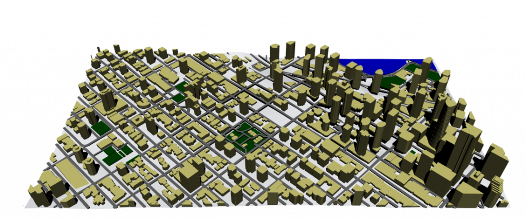
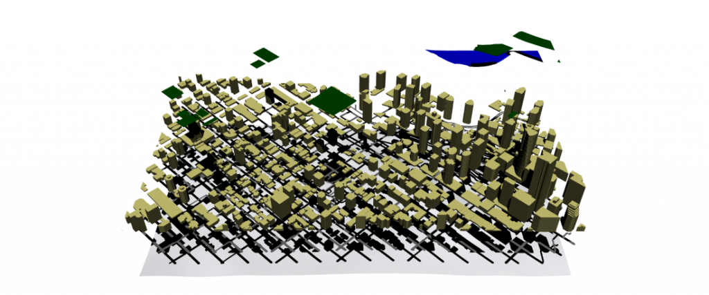
This is an update on the last post. I am creating more maps based on the last one. I also separated the layers of the different “instant” visual information within the map itself.
Greenspace is depicted in green. Coastline and water in blue. Buildings in gold. Streets in gray. Topography (concrete) in white.
The map size is 1km square or 1’000,000 meters squared.
Green spaces sum up to 39,150 meters squared, or 3.9% of the total area.
Water covers 27,427 meters squared, or 2.7% of the total area.
Streets represent around 192,366 meters squared, or 19.2%.
Buildings take up 2’040,902 meters squared. Double the area of the map itself or the topography available.
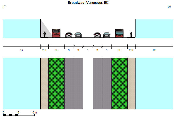
In order to get better understanding while doing my explorations, I decided to relate them to the city which I am a resident from: Vancouver.
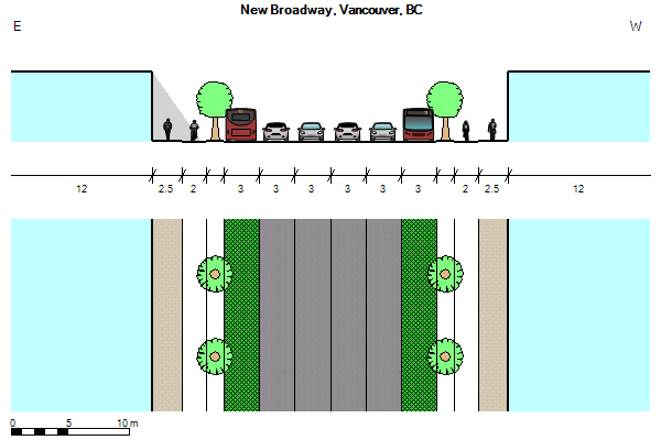
It is not a surprise that most North American city’s after the Second Industrial Revolution were modeled or adapted a more car-centric urbanism. I took Broadway as an example for this exploration.
This is a model of Broadway as it is now, with exclusive bus lanes and 4 car lanes. In the center there is another lane that serves as a left turn lane in pertinent crossings, but is removed mid block to give space for parking.
I wanted to see if with a less car-centric view I could accommodate the same traffic lanes and add space to other forms of transportation.
So, just by removing the flex space contemplated for parking/left turn lanes, it could be possible to add dedicated bike lanes protected with median strips lined with trees.
This simple exercise made me realized how much space in roads is contemplated or reserved for possible car usage.
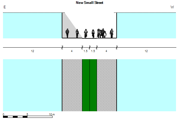
I decided to take a width of a small residential street, which usually has little traffic and thoroughly transforming it into a pedestrian-centric road.
In this case I widened the sidewalks to allow more space for pedestrians, dispersing crowds an important trait in a socially distancing world. Local traffic or emergency/service vehicles could take up the bike lanes in case its needed.
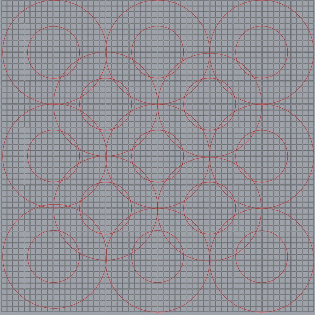
One of the explorations that I made, as I wanted to dig deeper in some of the insights from the summer research, was to create a grid pattern of blocks. Then, as an added layer, I created a pattern of circles, representing 1.5 km radius ̶ which is a 15-minute walk ̶ and 3 km radius or a 15-minute bike ride.
This simple grid represents a rather large city of 324 km2 ̶ around the size of Philadelphia ̶ . If we wanted to create a multi-center city, in this grid that would mean at least around 13 centers that could provide with all the services needed. This exploration of course does not take density into consideration, just area.
This would mean that a city like Vancouver (114.97 km2) would only require a minimum of 4 to 5 centers. In contrast, Vancouver is divided in 23 official neighbourhoods, a way to break up the city’s geographic area for delivering services and resources.
For this summer I decided to do a non-practice-based research in public space.
The goal of this research was to understand the close relationship between public space, epidemics and the public’s behaviour by doing a meta-analysis on existing discourse and conducting case studies.