
I will investigate the boundaries of my land through the action/s of cross-referencing, validating, reflecting
While chatting with Maleeka, usually something interesting and inspiring always stems out. Given our country’s bitter separation during Independence, and since decade’s of conditioning through multiple layers (education, politics, media etc) we look at our neighbours as enemy. This institution has provided a safe environment to start a dialogue and foster friendship.
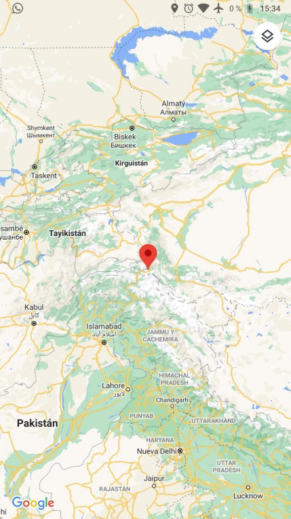
During one such conversation, where we were talking about the beautiful Jammu and Kashmir “Heaven on Earth” as told by Emperor Jehangir of the Mughal Empire. Lead us to google maps.
While looking at the maps and talking we were not able to orient ourselves.
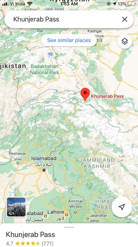
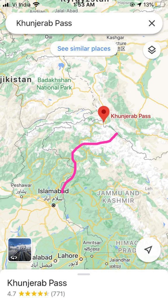
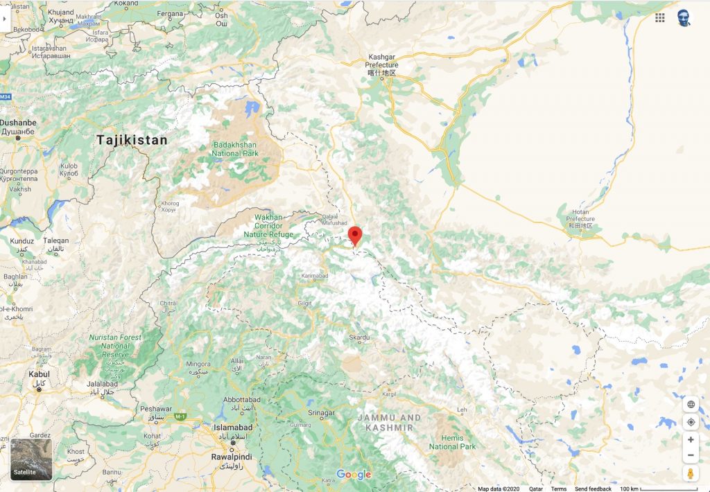
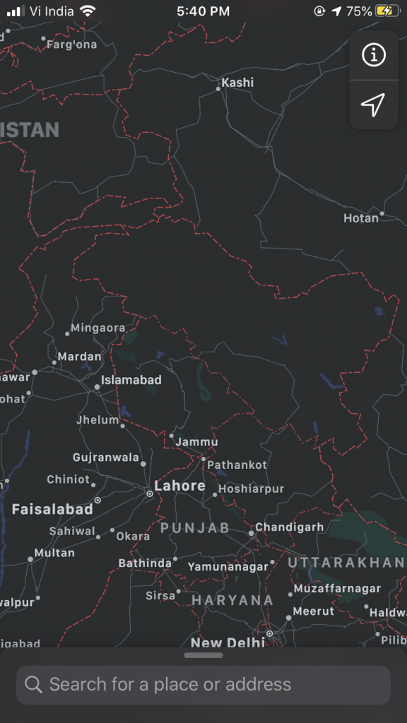
My Google map view
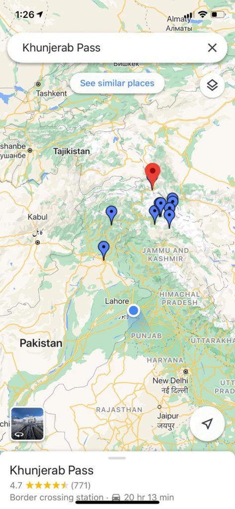
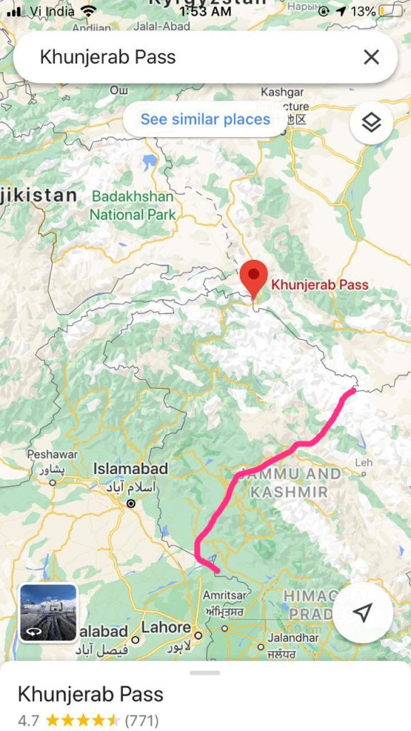
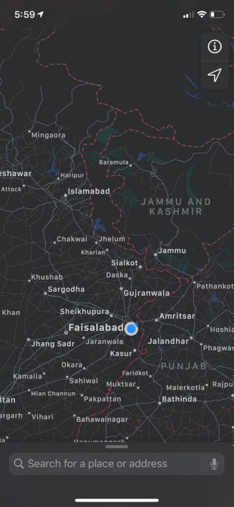
Maleeka’s Google map view
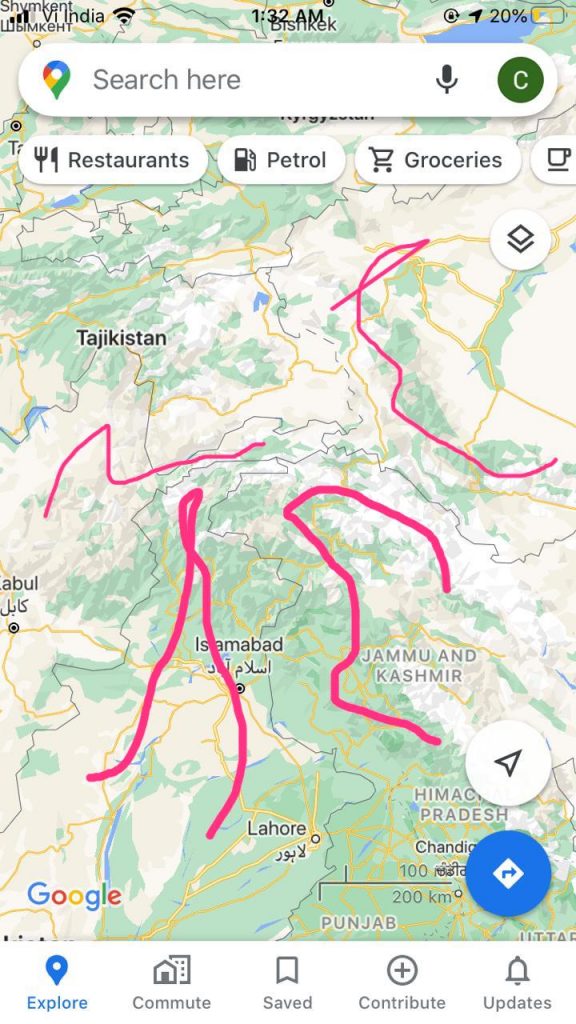
Us marking out the boundaries that we believed was true
My Google map view
Maleeka’s Google map view
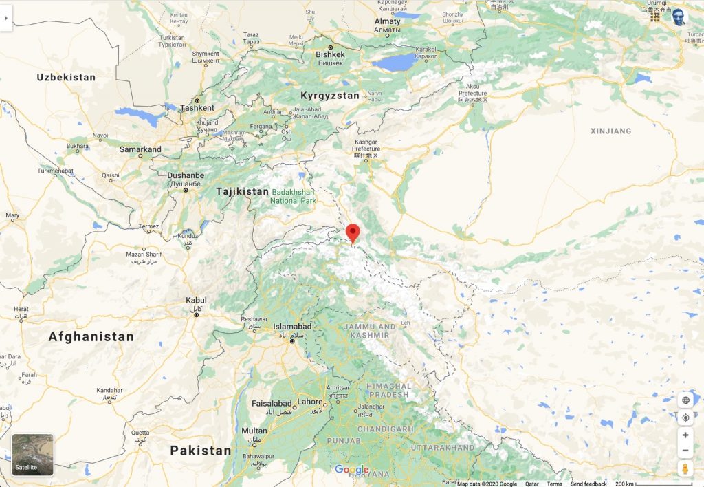
Trying to orient myself to an alternate reality
I trying to move the boundaries back
Moving it further back to match Maleeka’s
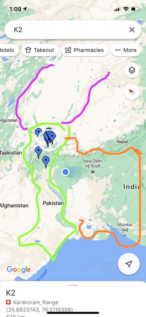
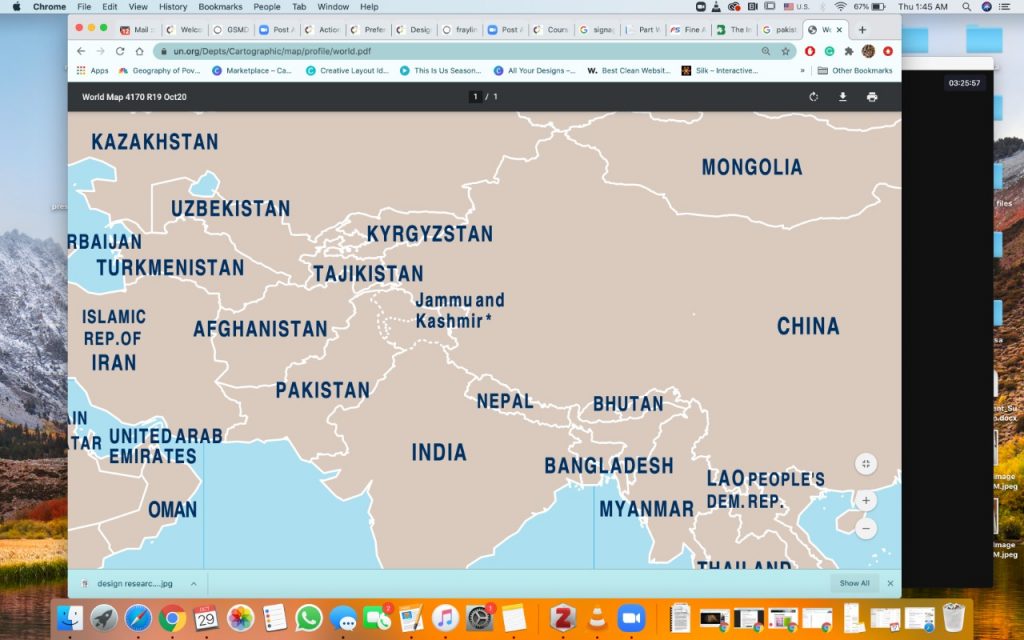
Us referring to UN maps, trying to make sense of this new information
This lead me to seek validation from 3rd party. friends, family in different countries.
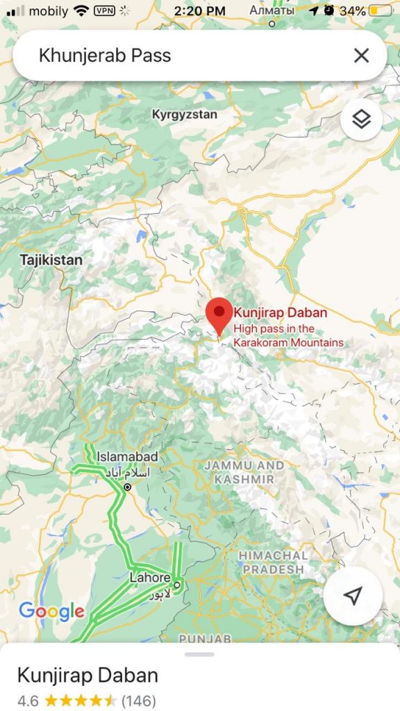
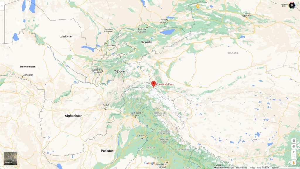
Below is the screenshot of google maps provided by Shankar (current location Oman, 23.11.’20) Satelite view 100-200kms
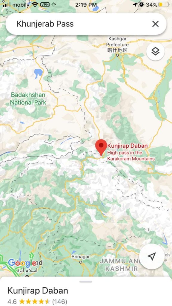
Below is the screenshot of google maps provided by Megha Mitra (current location Saudi Arabia, 23.11.’20) Satelite view 100-200kms
Below is the screenshot of google maps provided by Spandan (current location Australia, 23.11.’20) Satellite view 100-200kms
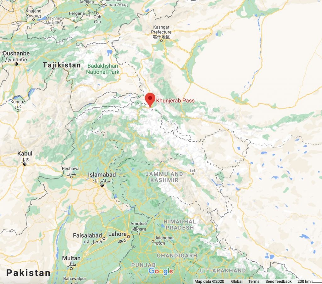
Below is the screenshot of google maps provided by Pablo (current location Canada, 25.11.’20) Satellite view 100-200kms. (Shows same as Indian Google map)
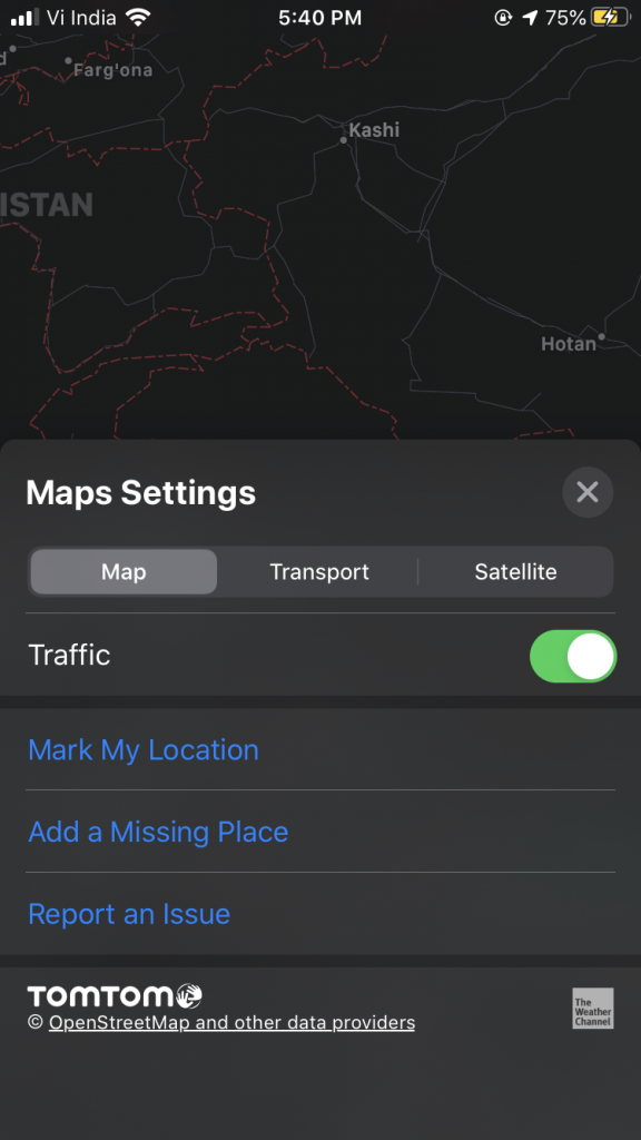
Below is the screenshot of google maps provided by Jeffery (current location ?, 25.11.’20) Satellite view 200kms
Below is the screenshot of google maps provided by Zahara (current location Iran, 25.11.’20) Satellite view 100
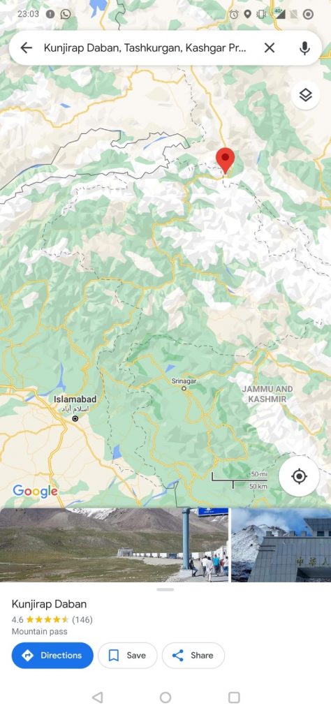
I check Apple maps which showed the new states that came into inception on 5th Aug,19 i.e. 1. Ladakh and 2. Jammu & Kashmir. But it’s international borders are not defined.
Maleeka's apple maps. ->
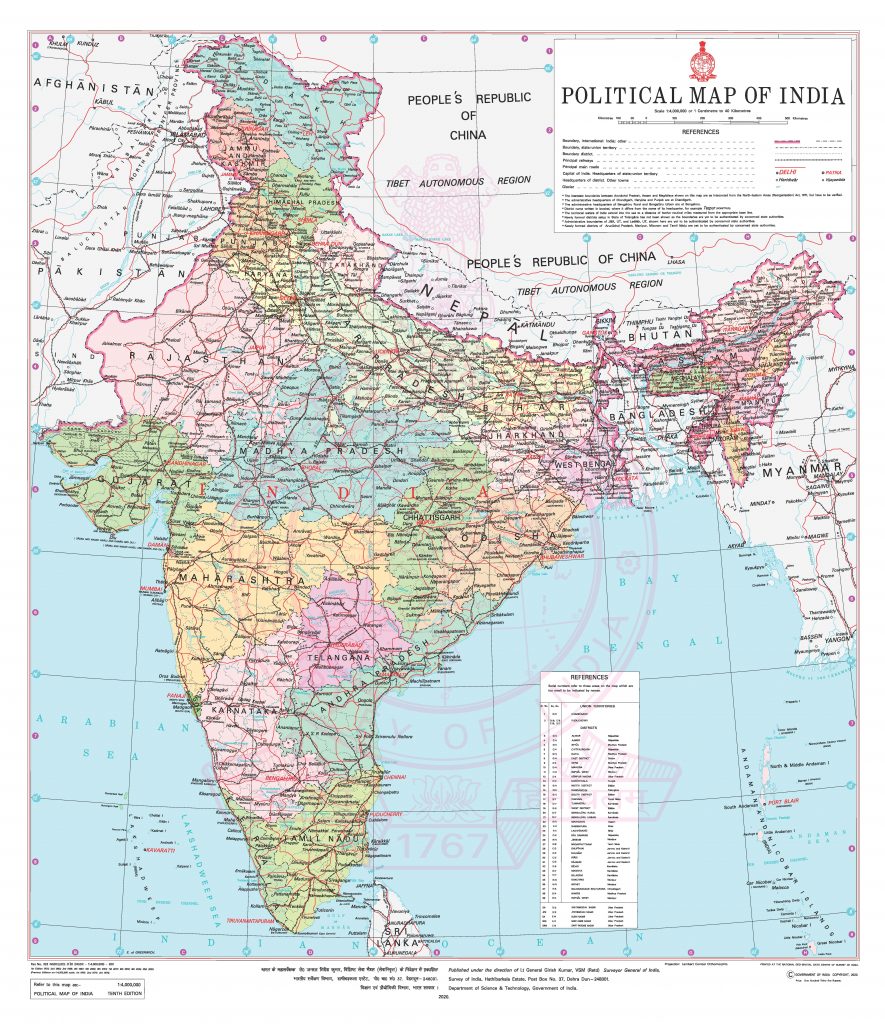
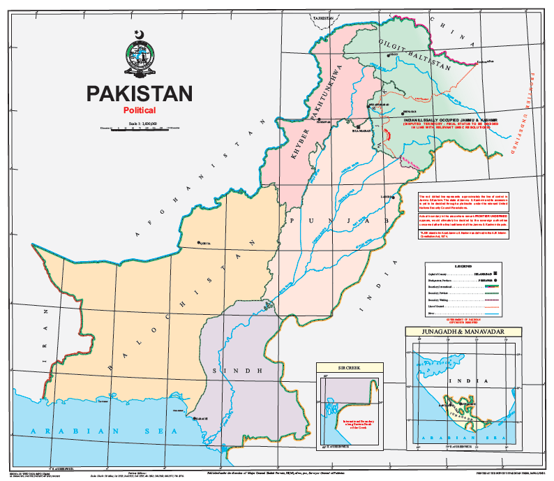
I checked the official map of Indian by Indian Govt. and the official map of Pakistan by Pakistani Govt
On 5th August,2019 India revoked Article 360, that granted special status to Jammu & Kashmir to a Union Territory of India into 2 states 1.Ladahak  and 2.Jammu & Kashmir.
Source: https://www.nytimes.com/2019/08/05/world/asia/india-pakistan-kashmir-jammu.html

There is a lot of things I need to understand: Who validates this? How is this new information be incorporate into things like, individual countries maps, tech application,curriences... what are other places this needs to be updated?

What data does google take to make these map? Why is it showing 2 different versions on the same platform.? what are its policies? How will the map change once I move to Vancouver?

How does this "visual depection of boundries" condition us.

How is data managed between 2 countires? the world? Who has the privilige/access to data? Who are marginalized?
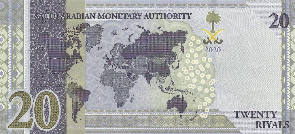
The Kingdom of Saudi Arabia could decide to ‘correct’ the ‘distorted’ map on its 20 Riyal banknote at the requests of the Indian government, reports indicated. Adding that Saudi Arabia is also likely to withdraw the banknote soon, reports said the two sides had reached a consensus on India’s position in Jammu & Kashmir.

Visual depection of boundries on print could have hughe political impact... it is also very costly to maintain it. Imagine reprinting the currency!!
I would like to take this action forward and do the following:
Provide a little more information about both me and Maleeka: where are we both writing from, how do we know each other
Provide a bit more background on the history and border issues: link to websites with basic historical explanations; discuss how the border issues are manifest at this time (is this urgent for me & Maleeka’s cohort, for example)
I could provide a final statement/conclusion that includes mine (and maybe Maleeka’s too?) reflections on the value of the casual data exchange between colleagues/friends (?) Do our final questions different? What are the issues (ethical, political, personal) raised in these data exchanges? Can I refer to some of the presentations in the series (data+knowledge sharing) in my analysis? Besides Dr. Namman’s talk, maybe Jessie Loyer’s talk about the trauma surrounding data sets might be worth exploring?
Best view i have ever seen !